
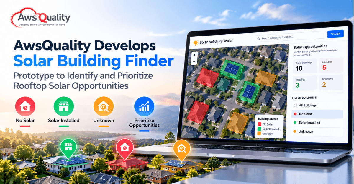
Finding the right rooftops is one of the first challenges in solar sales. Sales teams and installers need to identify buildings that may be suitable for solar, determine whether solar panels are already installed, inspect the available roof area, and decide which opportunities deserve attention first.
To explore a more efficient approach to this process, AwsQuality has developed a Solar Building Finder prototype—an interactive, map-based solar opportunity intelligence solution designed to help solar sales teams discover, inspect, and prioritize potential rooftops.
The prototype brings territory discovery, satellite-based roof inspection, solar-status classification, roof-area information, and confidence indicators into a single workflow.
What is the Solar Building Finder?
The Solar Building Finder is a prototype developed by AwsQuality to demonstrate how geospatial data and an interactive map interface can support solar prospecting.
Instead of beginning with a large, unqualified list of buildings, the concept is designed to help users move through three stages:
- Find buildings in a target territory and identify likely no-solar properties.
- Inspect individual rooftops using a satellite view.
- Prioritize opportunities using information such as roof area, solar status, and detection confidence.
The objective is straightforward: reduce the distance between identifying a potential market and determining which rooftops are worth sales attention.
Why Solar Prospecting Can Benefit From a Map-Based Approach
Solar sales teams often need to answer several questions before investing time in an opportunity:
- Where are the potential buildings?
- Does the building already have solar panels?
- How large is the available roof area?
- How confident is the classification?
- Which buildings should the sales team investigate first?
When these questions require separate tools or manual research, qualification can become time-consuming.
AwsQuality’s prototype explores a different workflow: start with a territory, visualize buildings on a map, filter them by solar status, select a building, and move directly into roof-level inspection.
The interface uses a simple color-coded system to make solar status easy to understand at a glance: red for No Solar, green for Solar Installed, and orange for Unknown.
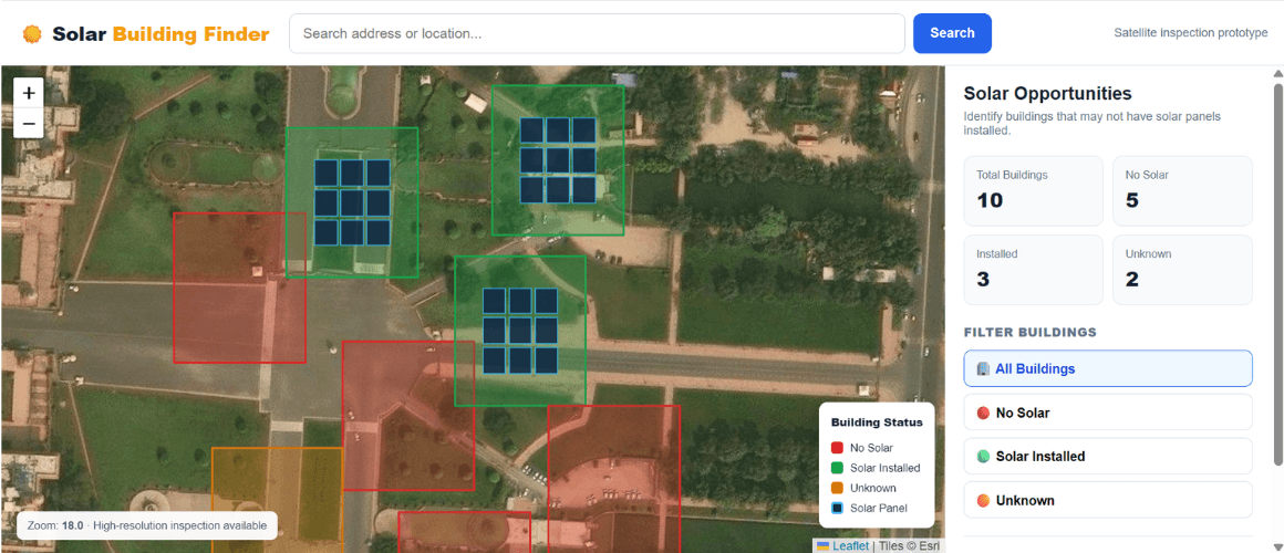
(Figure 1: Solar Building Finder territory overview showing buildings grouped by solar status.)
The prototype is designed around a single-screen experience that connects territory discovery with building-level inspection. Users can see the territory, distinguish building statuses visually, and use the filters to narrow the opportunity set.
How AwsQuality’s Solar Building Finder Works
1. Discover Solar Opportunities by Territory
The workflow starts with a target location or market. Users can search for an address, locality, or target market and then filter buildings according to their current solar status.
The prototype supports filters for:
- All buildings
- No solar
- Solar installed
- Unknown status
A user can then select an individual building to view its qualification information.
This creates a simple navigation path: City → Building → Roof
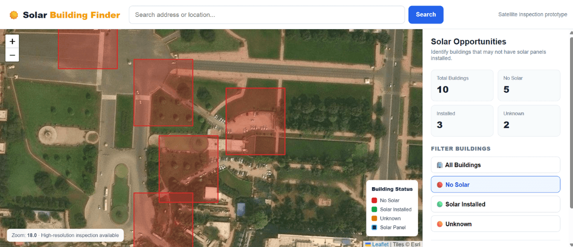
(Figure 2. No Solar filter: the interface isolates buildings identified as having no detected solar.)
The No Solar view demonstrates how filtering can turn a broad territory into a more focused prospecting list. In the prototype example, five of the ten buildings are classified as No Solar.
2. Inspect Individual Rooftops
After identifying a potential building, users can move from the territory-level map into a roof-level satellite view.
The prototype brings roof inspection into the same workflow, allowing users to move from a territory-level view to an individual building for closer inspection.
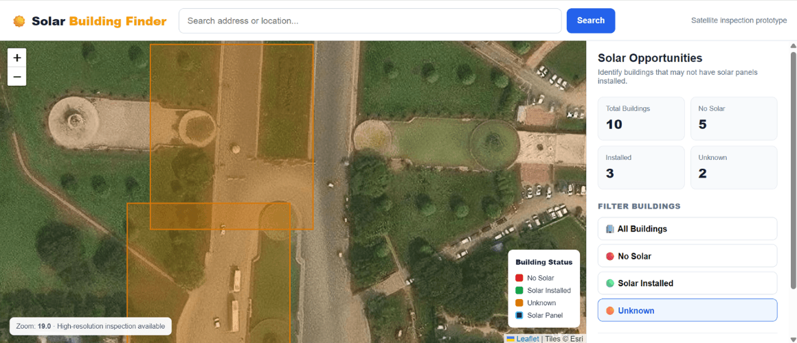
(Figure 3. Unknown-status view showing a building requiring further inspection before qualification.)
This view illustrates another important part of the workflow: not every building can necessarily be classified with certainty. The prototype therefore keeps an Unknown category so that uncertain cases can be reviewed rather than automatically treated as qualified opportunities.
3. Identify Existing Solar Installations
The prototype also allows users to isolate buildings where solar installations are already detected. This can help distinguish existing installations from potential new opportunities.
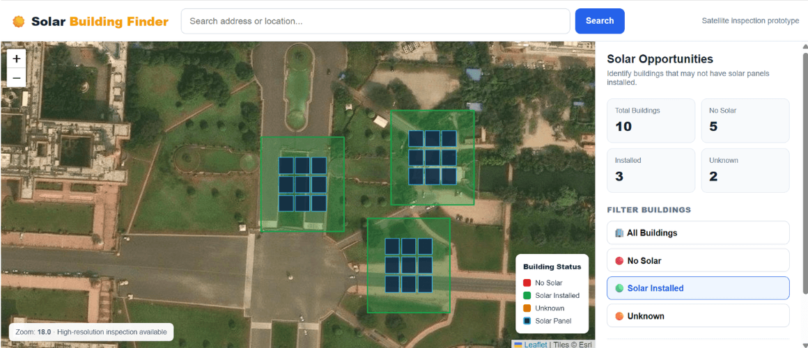
(Figure 4. Solar Installed filter showing buildings with detected panel overlays.)
In the prototype, the Solar Installed view uses green building overlays and blue panel markers to visually distinguish detected installations from buildings requiring further qualification.
4. Qualify the Opportunity
Finding a building is only the first step. Solar sales teams also need a consistent way to evaluate whether a building deserves attention.
The Solar Building Finder prototype brings several qualification signals together:
- Solar status: Installed, No Solar, or Unknown
- Roof area: Estimated usable surface
- Detection confidence: An indication of classification strength
- Panel count: Detected panels where available
The prototype also defines a future direction for opportunity scoring, where factors such as roof characteristics, irradiance, solar status, and commercial rules could be combined into a broader opportunity score.
What the Prototype Demonstrates
The prototype includes an example territory containing 10 buildings: 5 identified as No Solar, 3 identified as Installed, and 2 identified as Unknown.
These figures are part of the prototype demonstration and illustrate how a territory could be summarized visually for opportunity discovery. Teams can filter the territory and focus their attention on buildings that may require further investigation.
From Building Discovery to Sales Action
AwsQuality designed the prototype as more than a map visualization. It represents the front end of a broader solar intelligence workflow.
The proposed end-to-end flow is: Target → Discover → Classify → Inspect → Score → Activate
- Target — Select a territory or locality.
- Discover — Load building footprints within the selected area.
- Classify — Determine solar status and associated confidence information.
- Inspect — Review individual buildings using roof-level satellite imagery.
- Score — Prioritize opportunities based on available qualification signals.
- Activate — Move qualified opportunities toward exports, CRM workflows, lead assignment, or other sales actions.
The concept can potentially connect with CRM systems, GIS platforms, lead-management systems, solar design tools, and analytics dashboards.
Who Could Use a Solar Building Finder?
Although the prototype is centered on solar prospecting, the underlying intelligence workflow could support several types of organizations.
Solar Installers
Solar installers could use this type of workflow to identify potential rooftops before investing significant time in manual prospecting or site qualification.
EPC Companies
Engineering, procurement, and construction companies could use geographic opportunity discovery to prioritize territories and reduce manual screening.
Solar Financing Companies
Financing organizations could potentially use building and solar-status information as an additional signal when identifying commercial or residential opportunities.
Energy Aggregators
Energy aggregators could use geographic and roof attributes to develop a broader universe of potential distributed-energy opportunities.
Utilities and Energy Programs
Utilities or distributed-energy programs could use map-based intelligence to identify buildings that may be relevant to solar adoption initiatives.
Channel Partners
Solar channel partners could use the visual qualification workflow to give sales teams a more structured way to evaluate potential opportunities.
How AwsQuality Envisions Scaling the Prototype
The current Solar Building Finder is a prototype, but its architecture has been designed with a potential production platform in mind.
The deck separates the concept into four major layers:
Experience Layer
This includes the user-facing components such as:- Web maps
- Satellite views
- Roof inspection
- Filters
- Dashboards
Data Layer
This layer can incorporate:
- Building footprints
- Imagery
- Geospatial attributes
- Customer territories
Intelligence Layer
The longer-term intelligence layer can support capabilities such as:
- Solar-panel detection
- Confidence scoring
- Roof suitability analysis
- Opportunity scoring
Activation Layer
The final layer can connect qualified opportunities to:
- CRM systems
- CSV or GeoJSON exports
- Lead assignment
- Reporting
Separating the interactive map experience from the underlying data and detection services gives the concept room to evolve without rebuilding the front end.
From Prototype to Production
One of the important aspects of this project is the distinction between the prototype demonstrated by AwsQuality and a production-ready solar intelligence platform.
The current roadmap describes four stages:
Prototype → MVP → Intelligence → Production
- Prototype: Interactive map, satellite view, and roof inspection.
- MVP: Real building footprints and GeoJSON/GIS ingestion.
- Intelligence: Validated solar-panel detection and panel polygons.
- Production: Opportunity scoring, CRM/export capabilities, and territory analytics.
The current demonstration uses sample building geometry and sample panel overlays. A production implementation would connect the interface to authoritative geospatial data and a validated detection pipeline.
Why AwsQuality Built the Solar Building Finder
At AwsQuality, we work across areas including cloud, AI, data, web, and application development. The Solar Building Finder prototype brings several of these capabilities together around a specific business problem.
Rather than treating solar prospecting simply as a mapping problem, the prototype explores how geospatial interfaces, data, detection signals, and sales workflows can work together.
At its core, the prototype addresses a simple question: Which buildings in a target territory are worth investigating for solar?
The Broader Opportunity for AI-Powered Solar Intelligence
The Solar Building Finder also represents a broader opportunity for applying AI and data intelligence to energy workflows.
As geospatial datasets, satellite imagery, computer vision, and business systems become increasingly connected, solar organizations can potentially move beyond static maps and manually researched prospect lists.
A more mature platform could combine:
- Building and roof characteristics
- Solar-panel detection
- Satellite and aerial imagery
- Solar irradiance data
- Geographic information
- Commercial qualification rules
- CRM information
- Territory performance
- Historical sales data
These inputs could eventually support more sophisticated opportunity scoring and prioritization.
The objective would not simply be to identify buildings, but to help sales and operations teams understand which opportunities are most relevant and why.
Conclusion
AwsQuality’s Solar Building Finder prototype demonstrates a practical approach to solar opportunity discovery: find buildings, inspect rooftops, qualify opportunities, and prioritize sales action.
While the current version is a prototype using sample data and overlays, its architecture provides a clear path toward integrating authoritative geospatial data, validated solar detection, opportunity scoring, CRM connectivity, and territory analytics.
For solar installers, EPC companies, financing organizations, utilities, and other energy businesses, this type of platform could provide a more structured way to turn geographic data into actionable solar opportunities.
AwsQuality developed the Solar Building Finder prototype to explore exactly that possibility—and to demonstrate how modern web, data, geospatial, and AI capabilities can be brought together to solve a real-world business problem.
 Bio
Bio